










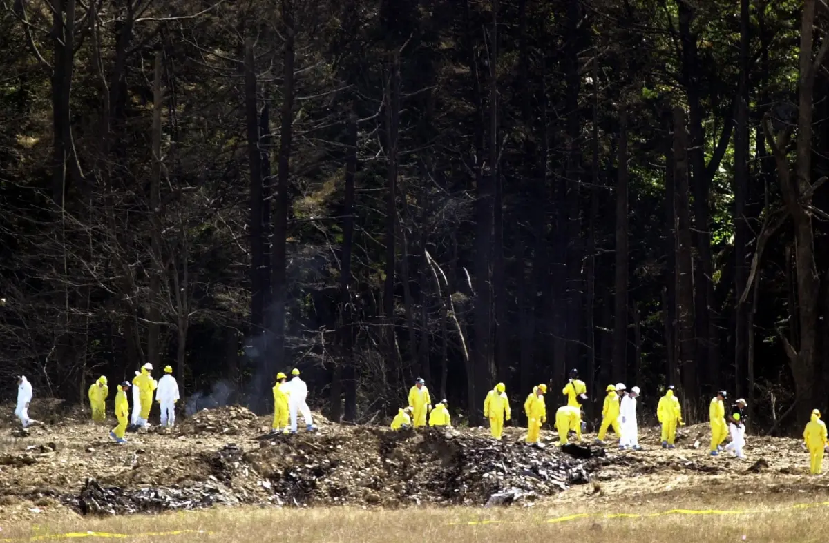
Main Facts: Uncovering a Fragment of 9/11 History in Northeast Ohio
On the morning of September 11, 2001, four commercial airliners were hijacked in a coordinated terrorist attack that permanently altered global politics, aviation security, and the American psyche. While the primary sites of devastation—the World Trade Center towers in Lower Manhattan, the Pentagon in Arlington, Virginia, and a field near Shanksville, Pennsylvania—became the global focal points of the disaster, the path to those moments stretched across regional skies, touching communities far removed from the primary impact sites.
Among those communities was Cuyahoga Falls, Ohio, a suburb north of Akron. Eyewitness evidence, corroborated by flight tracking logs, federal trials, and regional emergency management reports, confirms that United Airlines Flight 93—a Boeing 757-222 carrying 44 people, including four hijackers—flew low and erratically over Northeast Ohio during its erratic turnaround before heading southeast toward Pennsylvania.
       UNITED AIRLINES FLIGHT 93: KEY RADAR & EVENT POINTS
       ====================================================

  [08:42 EDT] Takeoff from Newark Liberty International Airport (EWR)
       │
       ▼
  [09:28 EDT] Hijacking occurs over Warren/Howland, OH area
       │      (Pilot radio transmissions: "Mayday! Hey, get out of here!")
       ▼
  [09:35 EDT] Aircraft turns south/southeast near Amherst/Oberlin, OH
       │      Descent begins; erratic banking maneuvers observed
       ▼
  [09:45 EDT] Low-altitude flight path traverses Summit County (Cuyahoga Falls/Tallmadge)
       │
       ▼
  [10:03 EDT] Flight 93 crashes into field in Shanksville, PA at 563 mph
For residents on the ground, including a seven-year-old student at Lincoln Elementary School, the sudden appearance of a low-flying, dark-blue-and-silver airliner breaking local airspace norms marked a moment of quiet dread. The event triggered long-lasting psychological effects, including severe aerophobia and trauma that persisted for a quarter-century.
This account explores the intersection of personal recollection and verified aviation history, detailing the timeline of Flight 93 over Ohio, the corroborating flight path data released by federal authorities, and the systemic, psychological impact on those who witnessed the low-altitude transit of a hijacked plane.

Chronology: The Timeline of Flight 93 and a Morning in Cuyahoga Falls
To contextualize the events in Northeast Ohio, the local experience must be mapped against the national timeline of the attacks.
+-----------------------------------------------------------------------------------+
|                        TIMELINE OF EVENTS: SEPT 11, 2001                          |
+-------------------+---------------------------------------------------------------+
| TIME (EDT)        | EVENT DESCRIPTION                                             |
+-------------------+---------------------------------------------------------------+
| 08:42 AM          | United Airlines Flight 93 departs Newark Liberty Airport.     |
| 08:46 AM          | American Airlines Flight 11 strikes WTC North Tower.          |
| 09:03 AM          | United Airlines Flight 175 strikes WTC South Tower.           |
| 09:28 AM          | Flight 93 hijacked over eastern Ohio near Warren/Howland.     |
| 09:32 AM          | Hijacker Ziad Jarrah makes accidental transmission to ATC.    |
| 09:35 AM          | Flight 93 alters course near Amherst/Oberlin; turns southeast.|
| 09:40-09:48 AM    | Low-altitude flight observed over Summit County, OH.          |
| 09:45 AM          | Federal officials order national grounding of all aircraft.   |
| 10:03 AM          | Flight 93 crashes in Shanksville, PA following passenger siege.|
| 03:30-04:00 PM    | Early dismissal/pickup of students across Summit County.      |
| 07:30 PM          | President Bush prepares address; local families view replays. |
+-------------------+---------------------------------------------------------------+
The Morning Routine
On Tuesday, September 11, 2001, weather conditions across Northeast Ohio were exceptionally clear, characterized by cool, early-autumn temperatures and high visibility. In Cuyahoga Falls, residents were preparing for the workday and school routines.
At approximately 09:35 AM EDT, a second-grade student outside a residence on Bailey Road observed an unusual disturbance. While waiting beside his family’s gold Dodge Intrepid, a deep, mechanical whine reverberated through the neighborhood, accompanied by noticeable ground vibrations. Looking upward, the child and nearby neighbors spotted a large commercial passenger jet flying at an abnormally low altitude. The aircraft, featuring United Airlines’ contemporary livery—a dark blue underbelly with a gray and silver upper fuselage—was conducting steep, erratic banking maneuvers.
Under normal circumstances, low-altitude commercial aircraft are absent from Cuyahoga Falls airspace. The region does not sit beneath low-altitude approach corridors for Akron-Canton Airport (CAK) or Cleveland Hopkins International Airport (CLE), with air traffic generally restricted to high-altitude transit, occasional medical helicopters, or seasonal aerial displays at Akron-Fulton Airport.

The Breakdown of Normalcy at School
Following the overhead passage of the jet, the student was dropped off at Lincoln Elementary School, entering the second-grade classroom of Mrs. Strubie. By mid-morning, as news of the strikes in New York and Washington spread, school administrators implemented heightened safety protocols.
Although staff attempted to shield young students from panic, signs of high alert were visible:
- Police cruisers actively patrolled Bailey Road.
- Outer entrances to the school facilities were locked.
- Stationed law enforcement personnel monitored the perimeter fence line during outdoor recess periods.
Concurrently, regional commercial entities initiated emergency shutdowns. Telecom employees, including field equipment installers for Lucent Technologies, were instructed to secure work sites and vacate by 10:00 AM EDT.
                 LOCAL IMPACT MATRIX: CUYAHOGA FALLS (SEP 11, 2001)
                 ===================================================

  SCHOOL OPERATIONS              COMMERCIAL/CORPORATE            FAMILY ENVIRONMENT
  ─────────────────              ────────────────────            ──────────────────
  • Lincoln Elementary locked    • Lucent Technologies orders    • Early pickups by 3:30 PM
  • Bailey Rd. police patrols      field staff home by 10:00 AM  • Continuous news broadcasts
  • Law enforcement at perimeter • Local medical offices receive   • Widespread confusion on
    fences during recess           disturbed caller reports        word meanings ("hijack")
By 03:30 PM EDT, parents and guardians began retrieving children early from after-school care facilities. During the drive home, parents were forced to explain unfamiliar terms such as "hijacking" and "terrorism" to young children while tuning into continuous news bulletins over car radios.

Supporting Data: Flight Path Analysis and Historical Verification
For years following the tragedy, eyewitness accounts from Northeast Ohio were subjected to scrutiny or dismissed as misidentifications of standard air traffic. However, federal archival documents, flight trajectory reconstructions, and investigative reporting confirmed the route taken by Flight 93.
Radar and Flight Data Reconstruction
Data compiled by the National Park Service (NPS) Flight 93 National Memorial, the National Transportation Safety Board (NTSB), and the Federal Aviation Administration (FAA) details the exact trajectory of the hijacked aircraft:
- The Hijacking Phase (09:28 AM EDT): Flight 93 was flying westward over eastern Ohio near Warren and Howland when hijackers led by Ziad Jarrah breached the cockpit. Radio transmissions picked up by the Cleveland Air Route Traffic Control Center (ZOB) in Oberlin, Ohio, recorded pilot Jason Dahl screaming, "Mayday!" and "Hey, get out of here!"
- The Turnaround (09:35 AM EDT): Jarrah disengaged the autopilot and turned the aircraft south and southeast over the vicinity of Amherst and Oberlin. During this turn, the plane descended rapidly from its cruising altitude of 35,000 feet to below 5,000 feet, performing sweeping, erratic banks as the hijackers struggled with the flight controls.
- Transit Over Summit County: Heading southeast toward Western Pennsylvania, the plane traversed the airspace directly over Summit County, including the municipalities of Cuyahoga Falls and adjacent Tallmadge. The low altitude, combined with the distinctive metallic scheme of United Airlines’ fleet at the time, made the aircraft clearly visible from the ground.
       FLIGHT 93 RADAR ALTITUDE RECONSTRUCTION (OHIO TRANSIT)
       =======================================================

 Altitude
  (ft)
 40,000 ───┐ [08:42] Departure from Newark
           │
 30,000 ───┴─────────────────┐
                             │ [09:28] Hijacking over Warren/Howland
 20,000 ─────────────────────┼─────────┐
                                       │ [09:35] Rapid descent/turn at Oberlin
 10,000 ───────────────────────────────┴──────────┐
                                                  │ [09:40-09:48] Low transit over
      0 ──────────────────────────────────────────┴────────────── Cuyahoga Falls
                                                                 [10:03] Crash
Corroborative Evidence and Public Disclosures
The timeline and flight trajectory have been cross-verified through multiple legal and public releases over the past two decades:
- 2006 Trial Exhibits: During the federal prosecution of Zacarias Moussaoui, the U.S. Department of Justice released comprehensive cockpit voice recorder transcripts and flight data recorder profiles detailing Flight 93’s path across Northeast Ohio.
- 2016 Archival Releases: Cockpit recordings, air traffic control audio files, and reconstructed radar plots were declassified and made available via public repositories, allowing independent researchers to trace the precise latitudinal and longitudinal points over Summit County.
- Local Emergency Statements: In September 2021, during the 20th anniversary commemorations of the attacks, local emergency officials—including former Tallmadge Fire Department leadership—publicly re-verified that Flight 93 had passed directly over northern Summit County at low altitude shortly before its final descent in Shanksville.
Official Responses: Airspace Closure and Local Security Protocols
The events of September 11 triggered immediate, unprecedented responses across all levels of American government, air safety infrastructure, and municipal law enforcement.

                  LEVELS OF RESPONSE ON SEPTEMBER 11, 2001
                  ========================================

    FEDERAL (FAA / NORAD)         REGIONAL (LOCAL LAW)           CORPORATE / SCHOOLS
    ─────────────────────         ────────────────────           ───────────────────
    • SCATANA Plan invoked        • School perimeters locked     • Telecom field work stopped
    • Unprecedented Ground Stop   • Bailey Rd. cruising patrols  • Medical offices briefed
    • Military escorts scrambled   • Stationed park/recess guards  • Early student dismissals
Federal Aviation Administration (FAA) Response
Upon recognizing that multiple commercial aircraft had been converted into guided weapons, the FAA took drastic measures:
- At 09:45 AM EDT, Ben Sliney, the National Operations Manager at the FAA’s Herndon Command Center (operating in his first day in the role), ordered Command Zero: a complete shutdown of U.S. airspace.
- All airborne civilian traffic—totaling over 4,500 aircraft—was ordered to land immediately at the nearest suitable airport under Security Control of Air Traffic and Air Navigation Aids (SCATANA) procedures.
- Military interdictors from North American Aerospace Defense Command (NORAD) were scrambled from Langley Air Force Base and Otis Air National Guard Base, though they were unable to intercept Flight 93 before it went down at 10:03 AM EDT.
Regional Emergency Response in Summit County
At the local level, security directives trickled down rapidly through county emergency management agencies:
- Law Enforcement Posture: Local police departments in Cuyahoga Falls, Stow, and Akron dispatched marked units to monitor key infrastructure, including water treatment plants, telecommunications nodes, and educational facilities.
- Educational Safety Directives: School districts instituted "soft lock-downs," retaining students inside classrooms, barring unscheduled visitors, and stationing officers at outdoor recreation spaces until early dismissals were coordinated.
Implications: Psychological Footprints and the Legacy of Collective Trauma
While physical destruction was concentrated in New York, Arlington, and Shanksville, the psychological footprint of the attacks extended globally, deeply affecting those directly beneath the flight paths of the hijacked planes.
       PSYCHOLOGICAL & DEVELOPMENTAL IMPACT TRAJECTORY
       ===============================================

  CHILDHOOD EXPOSURE (Age 7)       ADOLESCENCE & ADULTHOOD        LONG-TERM RESOLUTION
  ──────────────────────────       ───────────────────────        ────────────────────
  • Direct sensory impression      • Avoidance of air travel      • Re-examination of records
    (sound, low altitude plane)      (22-year aerophobia period)    (2006/2016 releases)
  • Immediate shift in worldview   • Anxiety linked to family     • Public documentation
  • Sudden sense of vulnerability    business travel                as therapeutic closure
Childhood Trauma and Aerophobia
Developmental psychology literature indicates that early exposure to terrifying events, combined with graphic visual media coverage, can produce persistent post-traumatic stress symptoms in children. For the seven-year-old child observing Flight 93 overhead, the experience dissolved a foundational sense of safety, leading to long-term severe aerophobia (fear of flying) that lasted over two decades—until the individual boarded a commercial flight for the first time in 2023.

Key clinical symptoms associated with this type of early exposure include:
- Acute Sensory Memory: Persistent recall of specific sensory details, such as the ground shaking, the distinctive blue-and-gray scheme of the aircraft fuselage, and the mechanical roar of low-altitude jet engines.
- Separation Anxiety and Fear of Travel: Intense emotional distress when family members underwent air travel in the years following the event, rooted in a fear of sudden hijacking or air disaster.
- Vicarious Loss: The shared grief of a community that lost members on the hijacked flights, such as local youth sports coaches lost aboard the planes that struck the World Trade Center.
The Role of Archival Records in Trauma Processing
For many survivors and eyewitnesses of historical disasters, the eventual release of official archives, flight recorder audio, and radar plots serves an essential function in trauma processing. The public release of Flight 93 cockpit data in 2006, along with subsequent digital maps in 2016, allowed witnesses to convert confusing childhood memories into verified historical facts.
Historical Perspective at the 25-Year Mark
As the nation approaches the 25th anniversary of September 11, the process of documenting small, localized witness accounts remains vital. While the macro-narrative of 9/11 is preserved in museums and national memorials, the individual stories of observers in places like Cuyahoga Falls demonstrate how deeply a national tragedy can alter the perspective, peace of mind, and lives of ordinary citizens far beyond the primary impact zones.
Summary of Corroborative References & Primary Sources
- National Park Service (NPS): Flight 93 National Memorial Historical Summaries and Transcript Archives.
- Federal Aviation Administration (FAA): Air Traffic Control System Command Center (ATCSCC) Historical Logs – Sept 11, 2001.
- United States District Court (Eastern District of Virginia): United States v. Zacarias Moussaoui, Trial Exhibits & Radar Reconstruction Plots (2006).
- National Transportation Safety Board (NTSB): Flight Data Recorder Study – United Airlines Flight 93 (Report No. 02-026).
- Tallmadge & Cuyahoga Falls Municipal Archives: Emergency Services Commemorative Reports and Regional Flight Path Corroborations (2021).